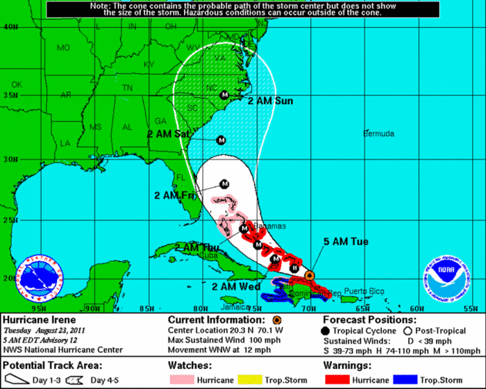
Image by National Weather Service The best guess for the storm as of 5 a.m. Tuesday.
Boasting 100 MPH winds, Hurricane Irene is moving to the west-northwest past Hispaniola before an expected curve at the East Coast as a major storm.
But the situation has improved from yesterday where the storm is expected to roll into coastal waters on a more northern trajectory.
And the computer models are starting to settle on the storm's path, the National Weather Service says, "There is considerably less difference among the various model solutions now, the overwhelming consensus is that Irene will gradually turn northwestward over the next 2-3 days and then move northward through a developing break in the subtropical ridge over the southeastern United States."
But as reassuring as the latest lines are, the National Weather Service reminds that "it is important not to focus on the exact track as the average errors are 200 to 250 miles" from where the storm actually lands.
Still, even if the path to land does not edge back to the west, a landing of a hurricane that powerful at North Carolina-South Carolina border would likely yield much rain and tropical storm-force winds.
To be sure, the weather service is giving Charleston a 50-50 chance of seeing tropical storm force winds at some point during the storm.
As always we'll keep an eye on it and pass along key updates.