A global warming awareness group is using data from new papers and a unique approach to help spread awareness of the risks tied with sea level rise.
Climate Central created a website that combines detailed map data with a Google Maps-style interface to make it easier to explore where the biggest risks are.
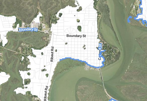
Show above is downtown Beaufort and, namely, how much of the Point stands a good risk at being submerged at least once by 2020 — or, more specifically, the non-white areas have at least 1-in-6 chance of being underwater at least once by 2020 thanks to the combined effects of sea level rise, tides, and storm surges.
By 2100 the report gives our are a 1-in-6 chance of seeing a rise at least once of more than 10 feet — something that would easily swallow much of Lady's Island, Mossy Oaks, old Port Royal, and much of the surrounding Sea Islands.
Check out the doomsday local map over here.
Not included in the study are the effects of a major hurricane that could easily swell several more feet.
Sea level rise is nothing new to the Lowcountry, and we've long heard about the risks it brings.